Showing posts with label Biking. Show all posts
Friday, June 17, 2016 0 comments

MECCA FOR BIKE RIDERS - PART 1 - JAMMU TO LEH

I present to you my travelogue to the dusty, barren, yellow-brown coloured yet enchanted, enthralling & stunning land up north - the best journey of my life till date!

Road trip to Ladakh – one of my bucket list wishes since quite a long time came true. Thanks to Atul (Husband), Sanujit & Pranav (Brothers), Prasad (Brother-in-Law) and Sunit (Friend). Well, I am not getting into details of the planning phase. In case anyone wants any kind of information do feel free to contact. 
OK, having said that I start my trip from Bandra Terminus.

DAY 1 & DAY 2
On 3rd August 2014, packing and leaving our bikes at luggage department the previous day, we boarded the early morning train from Bandra Terminus and waited for the train journey to be over, quite eagerly.

On reaching Jammu on 4th August, while some of us dumped all luggage in Hotel Surya Excellency (Below Gumat, Near Jammu bus station) the rest went to book a back-up vehicle for the trip. Later that evening we started finalizing the route which we were to take during this bike trip. All of us were super excited about the coming days.

DAY 3 (DAY 1 OF BIKE TRIP)
Date: 5th August 2014
Route: Jammu - Akhnoor - Tanda - Rajouri - Thana mandi - Bafliaz - Dera Ki Gali - Peer Ki Gali - Shopian - Srinagar 
Distance to be covered: 358 kms

On our way to Rajouri
We started off early in order to reach Srinagar before nightfall. After a simple yet filling breakfast at Tanda (Vishavkarma tea stall) we headed for Rajouri. The roads till Rajouri were smooth, meandering through the picturesque Kashmir valley, edged by luscious green trees and shrubs. We took quite a few halts to soak ourselves in this nature and be one with it.

The village of Thana mandi
After having lunch at Rajouri, we headed for Bafliaz (starting point of Old Mughal Road). The road till Thana mandi was in a bad condition and had heavy taxi traffic. In spite of the road condition watching the villages, flanked by the greenery and mountains on both the sides was too much fun. Thankfully the roads from here were in great state, climbing up and down the slopes of the mountains. It was an awesome experience riding through a canopy of trees and the clouds with the wetness settling on our helmets and jackets.

On crossing an iron bridge, we reached Bafliaz from where the most scenic and beautiful Old Mughal Road started. Mughal Road is an 84 km road between Bafliaz and Shopian district in the Kashmir valley, passing over Pir Panjal Mountain range, at an altitude of 11500 fts. Right from Bafliaz till Peer-Ki-Gali, the elevation level increased continuously. The entire road was amazingly beautiful; constantly riding through the dense clouds with every turn brought mind boggling views. On crossing Dera Ki Gali we took a much required tea break at Poshna top. From here we started for Peer Ki Gali, one of the most dazzling places on Mughal Road surrounded by lush green hills with tops covered with white snow. Looking down the deep and steep valleys was the energizing experience which is not possible to put in words. One has to be there to know what the real nature is. I sincerely wish that this place always remains the same. After high hills of Peer Ki Gali, we start descending towards the valley which passes through Shopian. We reached Shopian, quite late in the evening. Here, we had an unpleasant experience, due to which we immediately had to leave the place. One thing I really wish to mention is one should never visit this place after dusk and definitely not to take a halt and mingle with locals. Shopian localities are very hostile towards the Indians. The remaining stretch till the highway passed completely through forests and apple farms.
Bafliaz to Dera Ki Gali
Misty Pir Ki Gali

Finally we reached Srinagar at 9:45 pm. Definitely not the time to reach as per our plan, but no regrets. On entering Srinagar, firstly we headed towards Hotel Mughal Darbar near Dal Lake for dinner. This hotel was referred to us by some of the bikers, the specialty being Wazwan. Hard Core non-vegetarians must visit this place, but it’s not a place for vegetarians. Post dinner we checked in at Hotel Gulshan Valley. 

DAY 4 (DAY 2 OF BIKE TRIP)
Date: 6th August 2014
Route: Srinagar – Sonamarg – Zoji La – Drass - Kargil 
Distance to be covered: 240 kms

We started for Kargil quite later than we had actually planned (slept till late due to earlier hectic day). Didn’t get a chance to explore Srinagar due to lack of time, all we saw was Dal Lake. After having breakfast at ‘Delhi Di Rasoi’ (opposite Dal Lake), we started riding towards Sonamarg. The best part of riding out of the city was riding next to Dal lake for almost 30 kms and I was taken aback by its enormous size. The road later on became narrower and our bikes ended up getting stuck in traffic caused by Amarnath Yatra. Once we were back on the highway, all we could see was astonishing beauty of the nature. The roads were flanked by huge mountains… green pastures…. houses at the base of the mountain…. Just WOW!!!

We reached Sonamarg (also known as Meadow of Gold) in the afternoon and were in midst of mountains, Thajiwas glaciers and Indus River. Sonamarg is situated just before the Zoji La and is the gateway to Ladakh.  Sonamarg, besides Ladakh is the only place in India where you can see the Indus River. The scenery was breathtaking with lush meadows snuggled in the lap of the Himalayas, snow covered peaks basking in the sun and crystal clear blue watered river flowing in a serpentine way. It was difficult to capture the beauty of Sonamarg valley through lenses. Kahva (Kashmiri Tea) and sweet breads made this experience remarkable.

Breathtaking View of Indus               Humongous Thajiwas Glacier 


Treacherous Zoji La 
We headed to take on the most deceitful stretch of Zoji La (the 2nd highest pass on Srinagar – Leh highway, at an elevation of approximately 11,575 ft). Very mixed feeling, scared yet excited… The view from the base was breathtaking. On starting the ascent, we realized that the so called roads are nothing but broken fragments of rocks, ankle deep white powder, vertical valleys and steep incline. This is what
Deceitful Roads of Zoji La
makes this pass extremely risky and dangerous. ‘Nazar hati, durghatna ghati’ (Moment you get your eyes off, you will meet with an accident)… 
The first half of the stretch was relatively better. However after sometime it was getting difficult to ride on these roads as the bikes were skidding… Kudos to out riders!!! We were informed to get past Zoji LA before the army convoy to avoid getting stuck up for hours. However, the timings could not have been more wrong for us. Our 4-wheeler (with me sitting in it) was badly stuck up in the traffic. Meanwhile, bikes could maneuver and move ahead. It was pretty boring to get stuck so I decided to step out and I saw these enormous mountains staring down at me. Very daunting… Finally after 2 hours or so we managed to move towards Zero point where the others were waiting for us. The Zoji La was conquered at last! It was challenging, especially for the riders, but we had succeeded! After having Maggie and tea amidst the snow-covered mountains and glaciers we headed for Drass.

The roads to Drass were in a very good condition so we reached there in good time. Drass (“the Hell” in local Baltic language) is the second coldest inhabited place in the world after Siberia; the temperature dropping till -60o C in winters. The town got famous post 1999 Kargil War when it was shelled by infiltrators till the Indian Army recaptured the three heights, namely Tololing, Tiger Hill and The Three Pimples overlooking National Highway 1D that passes through Drass. Salute to our soldiers… Here we met a cyclist who was covering the entire Leh circuit on bicycle. Phew!!! Tough… After chatting with him for some time we headed for Kargil.

On our way to Kargil, I kept wondering how Kargil would be and I just couldn’t picture it. I had always thought Kargil to be a barren area (inhabited) where the war was fought. But I was surprised to see a quaint little busy town. Reaching Kargil by nightfall, we had trouble finding Vijayaka cantonment (military cantonment for Border Road Organization engineers, approx. 6 kms ahead of Kargil), our abode for night. The access to this cantonment is possible only if you have a military reference, which we luckily had thanks to Sanujit. Here we experienced the humble nature of our Jawans. We were provided freshly prepared dinner late at night. Not only this, we were also shown the army mess where our soldiers have their food. We were informed that we were just 11 kms from Line of Actual Control (LAC). Though we were very close to the LAC we were able to sleep soundly knowing that we were well protected by our Jawans.

DAY 5 (DAY 3 OF BIKE TRIP)
Date: 7th August 2014
Route: Kargil – Dah – Batalik– Khalste - Leh 
Distance to be covered: 340 kms

On our way to Batalik
Being in a photo-restricted area, I couldn’t capture the most memorable and humble abode. Offering our gratitude to the mess chef, we started our ride. The road was in excellent condition offering us a view of mountains on one side and steep valley on the other. It was a relief to ride on smooth roads. On our way to Batalik, we missed one turn and ended up near a bridge which would have taken us to the other side of the Kargil. On asking locals for the directions, we were suggested to visit Khud village from where we would be able to see LAC (Line of Actual Control). The
Towards Khud Village
road was recently tarred and the climb was quite steep. Even after riding for quite sometime we did not see any village. We made up our mind to go just 1 km ahead and return if we don’t see any sign of the village. Luckily, on our way back, we got an opportunity to talk to one of the many soldiers posted there and to experience the military hospitality in the middle of nowhere. Soldier Pawan Desai offered us hot water to drink and inquired about us and our trip. He told us that we were the first ones to come to this place and asked us to return back immediately since we were in the live firing range. Before returning I tied him Rakhi and I could see happiness in his eyes.
This was my first ever interaction with the soldier of Indian army and I was ecstatic about it. It was a very humble experience being able to interact with the defenders of the nation in such a harsh condition, serving the nation so that we can live peacefully. Salute to the soldiers…

We had to be very careful climbing down the road because of its steepness. Back on the road to Batalik, we tried asking several people for directions but were always misguided. Finally we came across a military truck that showed us the correct way to Batalik. The roads were tarmac like single lane roads, with infertile land interspersed with few fertile areas on both the sides and mountains on all the sides. One best thing about these roads is the cheeky safety phrases, thanks to the BRO (Border Roads Organisation). Some of the
phrases being ‘Darling I like you but not so fast’, ‘If you sleep your family will weep’, ‘Know aids no aids’, ‘Feel the curves do not test them’, ‘Driving risky after whisky’, etc.
Hamboting La
While taking the turns, we had to be extra careful as it was difficult to see whether the road turned right or left. The road started to climb gradually towards one more pass named
Hamboting La (altitude of 13,202 feet). Before reaching the pass we saw a small stall – Kazibain hotel – our savior. All of us were very hungry and even Maggie and boiled eggs seemed to be a treat. The Hamboting La had pretty decent


roads despite being at a higher altitude; probably
Maureen and sisters
because there is not much commercial traffic on this route. Finally we saw small villages with its beautiful people, ready to help you however they can. I met this beautiful girl named Maureen just before reaching Dah Village. Maureen along with her 3 sisters allowed us to take her photo, her smile was a killer. After talking to her for a while we headed towards Dah.


At Dah village
The Dah village, rightfully termed as “the land of the lost”, is 2 kms off the road. The road condition was so bad (probably on purpose so that not many people can visit the place) that at one point we felt that we were on a wrong road. On reaching the dead end we met a small kid who willingly took us on a tour to his village. Dah, one of the four main ‘Aryan’ villages of Ladakh, is isolated from the modern world. According to popular belief, the Drokpas were part of the army of Alexander the Great and came to the region over 2000 years ago. The Drokpas have retained their fair complexion and blue colored blues by marrying within the community to maintain their pure Aryan blood line. This community mainly thrives on horticulture, Apricot and apples being their main crops. Apricots, especially from Dah, are well renowned for their sweetness. We got a chance to interact with the Drokpas and also tried to click their photographs mainly in their tribal attire, but we failed to do so as they didn’t allow us to capture their photographs. But instead we were able to pluck apricots from the trees and enjoy its raw sweetness.

Glorious Indus
After visiting Dah, we had to report to the military check-post just before a bridge that takes you to Batalik. Here, we were able to interact with soldiers from Maratha Battalion. And once more I got an opportunity to tie rakhi… Very overwhelming to see them so happy and few of them got emotional as well. On crossing the bridg, we were thrilled to see Indus River flowing besides us for nearly 100 kms (till Khaltse). The Indus River was in its full glory here. The roads were single-laned tarred road. We had good time snaking through the turns with river on one side and prestigious mountain on the remaining 3 sides.

Arrow straight roads of Nimmu
Just before Khaltse, the roads became super smooth and super wide like the ones present in express ways. It was such a relief to ride on an arrow-straight-runway-like road. However our relief was short-lived… Enfield ran flat just 20 kms before Nimmu; it took us time to find a tempo to load the bike and get it fixed… We reached Magnetic Hill at night. This hill is famous for its anti-gravity phenomenon, where it is said that the vehicles move up the hill defying the law of gravity even when the engine is turned off. Well, we did not experience anything but the seclusion and stillness that this place offered. The entire road was lit up due to the moon light. It was simply dazzling!!!

The road till Leh was in a good condition and we managed to cover up our delay to some extent. Nestled in the Trans-Himalayan region, in the state of J&K in North India, Ladakh is one of the desired jaunts for nature lovers and adventurous souls. Tourists from all over the world swarm this mountainous region to explore the less explored jewels of nature. On reaching Leh (around 10:30 pm), we had to find a budget hotel. Our driver took us to Hotel Shaynam, which unfortunately was full. But thanks to our driver we were transferred to Hotel Abu Palace by Shaynam staff at the same rate..
Wednesday, June 15, 2016 1 comments

MECCA FOR BIKE RIDERS - PART 2 - LEH TO HUNDER TO LEH

DAY 6 (DAY 4 OF BIKE TRIP)
Date: 8th August 2014
Route: LehSouth PulluKhardung La TopNorth PulluKhalsarDiskitHunder 
Distance to be covered: 120 kms

We hired an Enfield standard so that we can leave behind the 4 wheeler and just ride the bikes for next 2 days. We carried 20 liters of petrol in jerry cans (There are no petrol pumps on the route except in Karu). We had 2 reasons to be super thrilled – 1. Conquering the K-Top (Khardung La Top– the highest motorable road in the world) and 2. Visiting the sand dunes at Hunder (Nubra Valley).   


Curvaceous Roads to South Pullu
The road leading out of Leh was very rustic with typical Ladakhi houses (brick & stone walls with wooden carved doors & windows.) lining up the road on one side… The road till South Pullu was in an excellent condition due to diligent maintenance by Border Roads Organization. A steady climb over the twisting road offered a panoramic view of Leh town with Stok Kangri peak in the
South Pullu in front of Stok Kangri
background. 
Huge mountains interspersed with trees and dainty ladakhi houses at the base offered an excellent view. It was very inspiring to see few cyclists riding down the K-top as it requires a lot of physical and mental strength to ride a cycle on this terrain and that too at such higher altitudes. After taking a small break
Road to K-Top
at 
South Pullu, we started our journey to conquer the K-top. Beyond this point, the roads started getting bad and climb was steep with substantial gain in altitude. The road condition started getting worse and the last few kms were really miserable. Just 2 kms before K-top, one of our bikes (rented one) stalled. We tried everything to get the bike started but with no result. Finally we had to call the rental service and asked them to come and fix our bike. Meanwhile all of us headed for K-top, with me and Atul in a mini tempo (thankfully it was passing by and agreed to take both of us to the top).

K-Top Conquered
Hurray!!! We finally reached Khardung La (Pass of Lower Castle). I felt like jumping and announcing the world about me being on the highest motorable road in the world. Over here even walking few steps was draining us out, forget about jumping. We were warmly welcomed by a soldier who offered us hot water to drink. Looking around I saw a medical post with few bunkers, Sarva Dharma Temple and
Snow Capped Mountains
Ganapati temple with prayer flags all around. It is not advisable (according to the soldiers) to stay here for more than 20-30 mins as the rarified atmosphere really hits hard. The oxygen over here is so less that it’s very common to feel nauseous, dizzy and even fainting. We were ecstatic on being here witnessing the power of nature, at the same time
Road to North Pullu as seen from K-Top
we were anxious about our stalled bike. At one point, Prasad started feeling dizzy
and had to be given oxygen immediately. While others were in the bunkers, I was enjoying the scenery which was simply stunning with the white snow-capped mountain peaks all around at almost a touching distance. I was having a gala time clicking pictures, chitchatting with other travelers and enjoying cool refreshing mountain air caressing my face. It was a rejuvenating experience. While chatting with the soldiers (who were playing carom in this freaking cold), I was shocked to hear that temperatures drop to -40o C with almost 10 ft of snowfall during winters. During the summer, temperatures hover around 20o C but the weather could suddenly turn worse and it may get bitterly cold. Hats off to the ‘Jawans’ who not only stay here but also work in these hostile environments.

Finally after almost 2 ½ hour of being on K-top, we headed down to North Pullu on the replaced rental bike. Proud of us to survive in this cold and at this altitude. As a pillion, though I was getting protected by the riders, I was shivering with cold.  I could only imagine how much more hard time the riders were having! Respect!!! The decline was lot worse than the ascent and I could feel each and every part of my body being jolted. On reaching North Pullu, seeing us in a bad condition, army people took us inside the camp and made us sit around a heater, offered us much needed coffee.

Here onwards till Khalsar the roads were again in a good condition, which was what all of us needed after the bumpy ride. Just before the bifurcation (Diskit on left and Panamik on right.), we had our dinner at around 9 pm (we had to literally plead to the owner of the hotel to open up and give us some food). Post dinner we headed for Hunder, the road was arrow straight and it was thrilling not knowing what is around us. All we could see was the road being illuminated by the headlights, the tail lights of the bike ahead of us and the moon illuminating rolling sheet of white on both the sides of the road. I didn’t know at that time that we were riding through the cold desert.

Serene White sand dunes
Finally we reached Hunder, secluded yet beautiful village sitting like an oasis in the middle of white desert in Nubra valley. This place is famous for its wide spread continuous dunes, Bactrian camels (two-humped camels found only in this region) and its breath-taking natural beauty. The tourists swarm this high altitude desert to watch the sand dunes glittering in moonlight. Our abode, Habib Guest house, was at a walking distance from the sand dunes and we were fortunate to see the surreal white sand dunes in the moon light at midnight. Awesome and a very appropriate way to end the day!!!


DAY 7 (DAY 5 OF BIKE TRIP)
Date: 9th August 2014
Route: Hunder – Khalsar – Agham – Wari La – Sakthi – Karu – Leh 
Distance to be covered: 160 kms

The moment I opened the door of our room, I was stunned by the beauty of the sand dunes and huge mountains looking down at us. Today we had to conquer the less travelled pass - Wari La (one of the toughest high altitude passes of Ladakh) I was apprehensive but what the heck… bring it on dude!!! 


Magical Land of Nubra
After having heavy breakfast we hit the road which was in good condition and we could see a vastness of sand dunes on our left. The white sand dunes, brown mountains and blue sky created a magical land before us. After Diskit the road was arrow straight with sand dunes on both the side. The view was surreal and simple WOW!!! After sometime the river took place of the sand dunes. The
Indus River
untouched,
 untainted beauty of the roads – breathtakingly beautiful vegetation along the river – everything seemed to have a tale of its own. On taking a mini break at Khalsar, we headed for Agham. The virgin beauty of Nubra Valley and traveling with like minded people was making this journey unforgettable.


Riding in extreme isolation
From Agham we took a turn for Sakthi. We took a break here to eat whatever we had coz we knew we would not be able to take a halt again if we were to reach Karu before night. Initially, the road seemed to be taking you inside a canyon but after a while the valley expands in front offering some breath-taking views. Suddenly I realized that we had not seen a single soul after crossing Agham. We were
Himalayan Marmot
just 
riding in extreme isolation of nature on our own. The mountains with snow capped peaks towards Wari La started to appear, standing tall and handsome. Initial ascent was gradual with lots of twists & turns, soon the climb started getting steeper and the riders had to put in a lot of effort to balance the bike on hairpin bends. There are just too many hair pin bends on this route. On our way to W-top we were lucky enough to see Himalayan Marmots (Belonging to the squirrel family these cuddly mammals with their squat body and short stocky limbs are swift to retreat into their burrows at the slightest hint of human approach). It was difficult to take their photos but finally few of them decided some publicity may be good for them and allowed us to take their snaps. After this point the roads started deteriorating and finally ended up being just a dirt track. Last few kms to Wari La (17400 ft), were
Dirt Track to Wari La
tricky with steep incline and rough roads making it very difficult to ride without skidding. All of us had a close escape on this stretch. The route is treacherous and the isolation along with steep incline at some place can turn up the white faces even for locals.
Eventually, we made it to the top of Wari La and feeling of excitement from nervousness jumped in… It was quite a pass, completely desolated, no one around, no shacks, nothing not even a bird to chirp. We knew our feat was commendable. The descent down from Wari La seemed to be equally tough, steep at times but the roads were comparatively better.


The roads from Sakthi were smooth so we managed to reach Karu before dark. After taking a tea break, we headed to Leh where we were dying to crash on the beds and sleep like a babies. 


DAY 8
Date: 10th August 2014
Rest at Leh


Anil Lama (Thangka Painting Shop)
This day turned out to be way different from what we had planned. Not going in much detail, we had issues with hiring taxi. Nonetheless, we got a much deserved break. Sunit bought Seabuckthorn juice, a berry which grows wild in the Spiti valley and is found in abundance along the river beds… The taste is not so amazing but it’s worth trying it…. Instead of sight-seeing we decided to shop. We bought T-shirts, Paintings, Prayer flags, souvenirs, etc, etc, etc…. After shopping we went for breakfast at café known as “My Secret Recipe”. Awesome place to eat… Later in the afternoon, while the guys went to DC office to get the permission for Chushul route, I decided to wander through the streets of LehLeh is one of the few destinations in India which is traveler friendly and charming. It’s a place which is easy to fall in love with… I could hear “Om Mani Padme Hum”, a Buddhist mantra wherever I went. The chant was captivating and it didn’t take much time to go in trance… On asking the meaning of the chant, I was told that Om represents the divine energy; Mani (Jewel) representing love & compassion; Padme symbolizes wisdom (wisdom of silence and emptiness) and Hum unifies spiritual methods with wisdom. It represents the spirit of enlightenment. Hum destroys the suffering. One of the shop keeper said that the chant signifies infinity.  Besides the colorful panel of rectangular prayer flags and the engraved rocks, this mantra travels along with you.

The best part of Ladakhi culture (according to me) is the way the natives greet you with the word “juley”, wearing a smile that comforts you to the core. Just loved it…. I got so impressed that I started saying Juley to anyone on the road, be it the natives, tourists or the shopkeepers. Just fell in love with the word… 


For dinner, we went to La Pizzeria to celebrate our successful conquering of Khardung La and Wari La… We had a nice time there and by midnight we were ready to crash on beds.      
0 comments

MECCA FOR BIKE RIDERS - PART 3 - LEH TO PANG

DAY 9 (DAY 6 OF BIKE TRIP)
Date: 11th August 2014
Route: Leh – Karu – Chang La - Lukung – Spangmik
Distance to be covered: 120 kms

Finally the day arrived when we would be seeing the glorified Pangong Lake… Extremely thrilled just by the thought of it...

After having an heavy breakfast, we started our ride, this time accompanied by our driver (backup vehicle) Thunduk and navigator Phunsuk. Road from Leh to Karu was in a good condition and the journey was fast paced. Entire route was lined with many petite villages and white Chortens (basic structure consists of a square foundation symbolizing the earth, dome symbolizing water, and thirteen tapering steps) which offered a
Engravings on the rocks
scenic view of the arid Ladakh. We reached Karu in less than an hour. On the opposite side of the check-post, where we halted to get our documents and permit verified, we saw stones of various shapes and sizes. On having a closer look, to my utmost surprise were minutely detailed engravings on each and every stones… 

Ascent to Chang La
From Karu, the road bifurcating to Sakthi (at the foothills of Chang La) was mostly straight and tarred with beautiful sceneries around. One can see the roads slowly snaking its way to the top of the mountains… While continuing our ride on tarred roads, we started experiencing the real climb for Chang La. For the most part, the climb was steep and in good condition. The road takes you through steep rock faces on one side and a deep cliff on the other side. As
Deteriorated yet beautiful roads
we approached the final kms, road condition deteriorated. The only saviour was beautiful landsacpe around us. Even Enfield refused to climb with a pillion, so I had to get down and climb some feet (I was struggling to breathe and walk at the same time)… Finally I reached the point where Sanu was waiting for me. We rested there for a while, hopped on the bike and easily covered final few kms…
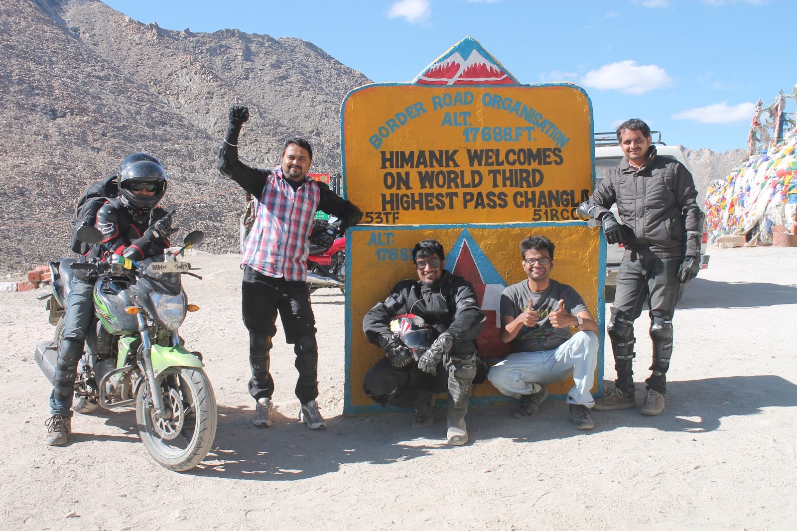
The moment we reached Chang La top
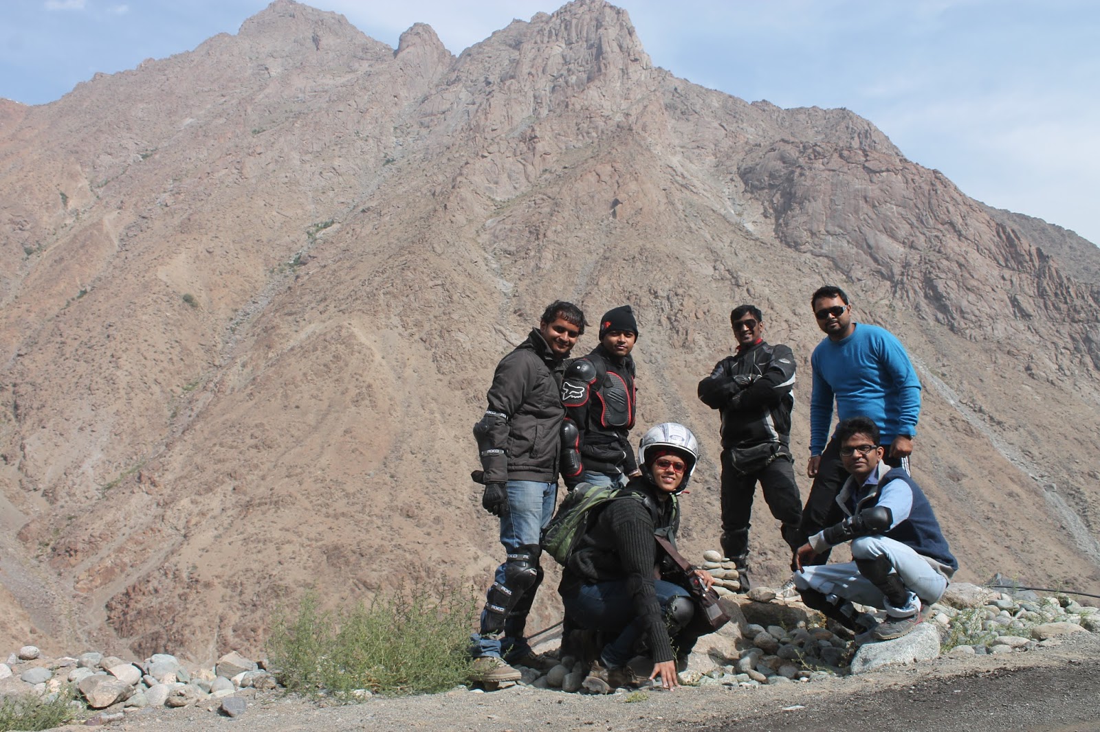
Boys at Chang La Top
(evident by the sign post erected by the Indian army), what struck me the most was the snowcapped mountains and the tranquility surrounding the Chang La… Chang La, the world’s 3rd highest pass (height of 17,590 ft.) was comparatively easier to conquer and not that desolated when compared to Wari La.

Jaw dropping Landscape
After enjoying the view and some photography, we headed for Spangmik. The scenic beauty was jaw-dropping; small channels of water accompanying us on our journey, barren mountains, blue water surrounded with green pastures and horses grazing in these pastures. We came across a river crossing with gushing muddy water making our ride difficult… Pillions had to get down and find a way to cross the river… Riders did a good job navigating the bikes through the water. 

Serene Pangong Tso
As we were nearing Pangong Tso, my excitement grew. I was waiting to see those lovely shades of blue and when we reached I heaved a sigh of relief… Finally we reached the Pangong Tso before sunset (this was my Raksha bandhan gift from Sanujit). As soon as I saw the lake I fell in love with the alluring beauty of the blue water that I had never seen before. We could not take your vehicle till the shore, so we had to walk down. We found an isolated place
Fun time at Pangong Tso
to enjoy the serenity of the lake.  It was a challenge for us to walk; by the time we reached the waters it was dark and had started to get chilly. We decided to sit there for a while; all we could see was water, water and more water… for as far as your eyes can see. And then you see mountain range that separates us from China, beyond which lies a larger portion of Pangong Tso. It was a surreal view… We took some photographs and enjoyed the sound of water which had a very soothing effect on me…. I also dared to soak my feet in the ice cold water. Later on I had to suffer because of my impulsiveness. But no regrets…  

After spending time here, we headed for the pit stop of the day i.e. Spangmik. From the lake till the village, the road was bad with water crossing after every few feet of riding. Luckily we did not come across black ice. Thanks to Thanduk, we easily got a decent homestay (Padma Homestay) just a few minutes away from the lake. Homestays are far cheaper and comfortable giving a very homely feeling. The house lady made us one of the most delicious dinners we had till now. It was very cold and I couldn’t wait to get under the duvets and hit the bed.


DAY 10 (DAY 7 OF BIKE TRIP)
Date: 12th August 2014
Route: Spangmik – Merak – Chusul – Chagga – Loma – Mahe – Karzok
Distance to be covered: 160 kms

Good Morning Pangong Tso
In the morning we got to enjoy the exhilarating view of sunrise sitting on the banks of the crystal clear lake, the color of which changed from dark blue to sapphire blue in front of our eyes… Simply mesmerizing… It was very refreshing to stroll on the banks, soaking the magnificent view before heading for Karzok. Today we were to explore a region where very few people have managed to reach…  

Since the roads were supposed to be bad, it was decided that Atul, Sanujit and Sunit would
Roads or dirt tracks??? 
ride alone while remaining of us sat in the car. As soon as we left Spangmik, the roads turned out to be beautiful yet worse than we had imagined. Beautiful ‘coz the entire route was almost completely alongside the scintillating Pangong Tso. The riders had a really tough time navigating through terrain which changed slowly from rocks to
Crossing the rivulets 
sandy to dusty roads (if we can call them roads)… The so called road was nothing but trails left by the vehicles that may have passed… Luckily our driver had been on this route earlier so the bikes rode behind the car. The roads were interspersed by rivulets which were a task to cross as bikes were skidding due to round smooth stones and the flowing water. We finally got an opportunity to see Kiangs, the largest of the wild asses found in Ladakh region.
Royal Kiyangs
I was in awe by the gracefulness of these animals especially the way they run with their heads held up as if saying “I am the king of this region” and tails swaying behind them in the wind. They look very noble in their coat which is light brown on the back and whitish below the belly, black hair on their neck and tail; their entire body camouflaging extremely well against the natural background.

Finally we reached Merak where we had to show the permits to cross Chushul. Going ahead we reached Khakste, the last village before Chusul, here the Pangong Tso Lake turns into Tibet.

Heroic Land of Chushul
Finally we reached the Heroic Land Chushul, where we were again asked to show the permits. We were a little concerned; whether we would be allowed to go further even after having the necessary permit. It has happened earlier with some travelers who were denied the entry even after having the permits and they had to return back to Spangmik. Luckily we got a green signal to go further. We were informed that photography is prohibited in whole inner line as per official
Roads??? Where???
rules as this region being too close to the LAC. With the instructions from the army, we started for the journey less taken… We were very excited at first but looking at the terrain, made me little doubtful… It was so easy to get lost here due to lack of the actual road or even a dirt road. Our only hope to reach the other side was our driver… Slowly I started enjoying the solitude of the land of Borders. We could see the China border on our left and remembered the warning given to us by the soldiers at Chushul check-post that travelling towards the left, we would enter Chinese Border and the things would get tough. Magnificent and massive mountains, blue sky and stream playing peek-a-boo were our constant company. The beautiful ride through barren land was interrupted by an event which was un-called for. One of our bikes fell in the water while crossing a swollen stream with gushing water. Luckily Sunit was not injured nor was he wet. But the bike refused to start up even after making the bike stand vertically at 180o both on the head light and on tail light for removing all the water from the carburetor… After too many tries and a little help from the army soldier, we started our journey again but we were delayed by 3 hours…

Salute to Lt. Col. Nimbalkar
& Soldier Sanjay Singh
We ascended the hill to reach Chagga La, also known as Tsaga La. This pass goes unnoticed due to lesser elevation and relatively gradual climb. While ascending we came across a swollen stream with gushing water yet again. We were tensed to cross the stream on bikes especially Sunit’s. Luckily a military gypsy passed by and stopped to inquire about our trouble… Lt. Col. Nimbalkar and Soldier Sanjay Singh got down and suggested that we should load Sunit’s bike in their gypsy. Sunit’s bike safely reached the other side of the stream. Colonel himself removed his shoes, rolled up his pants and stood in middle of the stream to guide other two bikers to cross… They also offered us chocolates and juice to carry with us… A very humble gesture by our soldiers just to ensure we ride safely.... A big salute to them……

We descended into the Tsaga village where we had to register at the check post before heading towards Loma. Road from here till Loma was in pretty good condition and the pillions were back on the bikes… The riders agreed that the thrill of riding through Chushul on a bike was truly something! Though the stretch was exciting but the pillions could not get that feeling in a car. Everything beautiful seemed less stunning when seeing it from a car. But most definitely what we saw around was dazzling… (I guess we were just missing being on the bike!)

Myriads of colours
We reached Loma in no time. On crossing the bridge on the left of the check post where we had to register ourselves, was the Hanle (home to the highest altitude Indian Astronomical Observatory)… How I wish we could have managed to go there, but there’s always a next time…  Roads from here were a mix of good and bad, trying to find its way through mountains with different shades of brown, clear blue sky with white fluffy clouds, brown soil turning to green pastures towards the mountains…. On our way we saw black-necked crane. (These medium sized - mostly grey colored with black head, neck and tail - migratory, legally protected vulnerable birds come in this region every year for breeding).

We reached Mahe by late evening, where there was a check-post and to the left was the Mahe bridge… Right after this bridge, the road became bumpy, and ascent to some pass started. The ascent was not that steep; however after crossing the pass suddenly the road disappeared and gave way to dirt tracks until Karzok…. Again from here we asked our driver to drive in front of the bikes…. Continuing on the dirt track, we came across a bifurcation, from where we headed straight instead of going left… Proceeding through the sandy & soft soil, the path was getting scarier. On top of it was the darkness….

We reached Karzok quite late at night… We stayed at Mentok Guest House where we crashed after celebrating at midnight… Well the celebration was for my second anniversary… At midnight Atul surprised me by gifting me a beautiful Ladakhi neckpiece… He was equally surprised when I opened the box of cookies and pastry…. All of us stayed up for some time and retired to wake up fresh next morning. 


DAY 11 (DAY 8 OF BIKE TRIP)
Date: 13th August 2014
Route: Karzok – Moore Plains – Tso kar – Pang
Distance to be covered: 140 kms
Enjoying

We headed to have a glimpse of Tso Moriri Lake… Wow!!! What a way to start our anniversary… It is very difficult to express the gorgeousness of this lake in words.  I found this lake to be more beautiful than the Pangong Lake. Also known as the ‘Mountain Lake’, this exotic lake with its deep ultramarine water surrounded by golden mountains and snow peaks gives a surreal experience. Endless vastness
Picturesque Mountain lake
and sheer raw beauty of this picturesque landscape gave us a sense of untouched purity. The serenity that I experienced while standing in the lake bare footed (super chilled water) made me feel out of this world. This incredible place offered so much to capture in one glance. After spending some time being one with the nature, we headed for Pang. I just couldn't stop staring at it even while riding.


Deserted Roads to Tso Kar
As the road were little rough, Me, Atul and Pranav decided to travel by car so the riders would have little difficulty while riding bikes. The route till Sumdo was same as we had taken the previous day to reach Tsokar. The road improved a little bit compared to what we had faced earlier but it was still jeep tracks with small rocks and pebbles. On crossing the Sumdo, we observed that the roads were deserted; reminding me of Chushul.


Stunning Landscape
The drive up from Sumdo to Tso Kar is incredible. For few hours and few kilometers we were the only breathing creatures on 3 bikes and a 4-wheeler on that road. The changing pattern in the terrain was simply stunning. After driving through few twists and curves, the landscape unfolded itself and all we could see barren mountains with snow peaks and Tso Kar Lake in front of us. The lake was shimmering under the gaze of the sun and it appeared as if covered with diamonds. The view was absolutely fabulous. Region around Tso Kar is a wide open valley with a small road passing around it. The valley looks like a desert, barren and dusty. We saw a herd of Kiangs near the lake and were dying to take a detour and go near them, but due to time crunch we had to go ahead to reach Pang on time.


On Moore Plains
The roads improved a bit with only small pebbles scattered on the road; however the roads were still bumpy and arrow straight. Travelling on this road was awesome as compared to roads travelled earlier that day. But this sense of relief was short-lived as we again started riding on dusty and bad roads. Later I came to know that we had already crossed Moore plains… I was a little disheartened as I had read a
Ibex Skull
lot about it… We reached a small village where we halted for tea and snacks. The most striking thing about this place was the head of yak displayed on one of the houses… What a sight on entering the village… We went to one of the food joints for lunch and there was a skull of Ibex outside the entry of the tent.
Bikers of Mumbai and Pune
Another thing which gained my attention was the red color of the surrounding mountains as compared to the brown ones. Here we met some of the bikers from Pune and Mumbai. We exchanged our experiences and we asked them if they have any spare petrol with them. We were really low on petrol and were not sure if it would last till Pang. They gave us 5 lts of petrol and didn’t even take money us. That’s bikers’ spirit and I just loved it… After spending some time chit chatting with the boys, we headed towards Pang.

The road from the village till a junction, where the road from Leh meets this route, was super smooth and we reached the junction in no time. On reaching the junction, we decided to buy petrol from the small dhabawallas on the road. The petrol was super expensive; we tried to bargain but ended up paying whatever they asked for. The road till Pang was as good as ever except the last 10 kms where the road was bad and extremely bumpy.

Experimental photography
We reached Pang by night. It is the world’s highest Military Transit Check point. We stayed at Padma home stay which was a small concrete house having dormitory and 3 tents. It was chilly out there and difficult to be out in the open. Till our dinner was being made, we decided to experiment night photography. We also saw Milky Way which we tried to capture on camera but we failed to do so. The dinner was awesome and after long we were watching hindi serials. Post dinner we were off the bed.
 
;