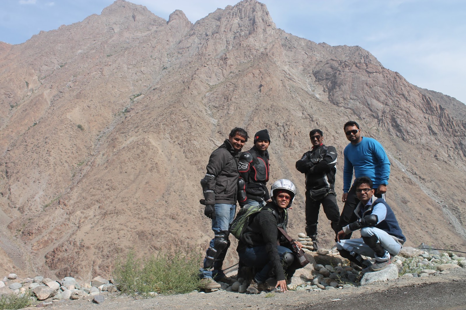
I present to you my travelogue to the dusty,
barren, yellow-brown coloured yet enchanted, enthralling & stunning land up
north - the best journey of my life till date!
Road trip to Ladakh – one of my bucket list
wishes since quite a long time came true. Thanks to Atul (Husband), Sanujit
& Pranav (Brothers), Prasad (Brother-in-Law) and Sunit (Friend). Well, I am
not getting into details of the planning phase. In case anyone wants any kind
of information do feel free to contact.
OK,
having said that I start my trip from Bandra Terminus.
DAY
1 & DAY 2
On 3rd August 2014,
packing and leaving our bikes at luggage department the previous day, we
boarded the early morning train from Bandra Terminus and waited for the train
journey to be over, quite eagerly.
On
reaching Jammu on 4th August, while some of us dumped all luggage in
Hotel Surya Excellency (Below Gumat, Near Jammu bus station) the rest went to
book a back-up vehicle for the trip. Later that evening we started finalizing
the route which we were to take during this bike trip. All of us were super
excited about the coming days.
DAY
3 (DAY 1 OF BIKE TRIP)
Date: 5th August 2014
Route: Jammu - Akhnoor - Tanda - Rajouri - Thana mandi - Bafliaz - Dera Ki Gali - Peer
Ki Gali - Shopian - Srinagar
Distance to
be covered: 358 kms
 |
| On our way to Rajouri |
We started
off early in order to reach Srinagar before nightfall. After a simple yet
filling breakfast at Tanda (Vishavkarma tea stall) we headed for Rajouri. The roads till
Rajouri were smooth, meandering through the picturesque Kashmir valley, edged
by luscious green trees and shrubs. We took quite a few halts to soak
ourselves in this nature and be one with it.
 |
| The village of Thana mandi |
After having lunch at Rajouri, we headed for Bafliaz
(starting point of Old Mughal Road). The road till Thana mandi was in a bad condition and had heavy
taxi traffic. In spite of the road condition watching the villages, flanked by
the greenery and mountains on both the sides was too much fun. Thankfully the
roads from here were in great state, climbing up and down the slopes of the
mountains. It was an awesome experience riding through a canopy of trees and
the clouds with the wetness settling on our helmets and jackets.
On crossing an iron bridge, we reached Bafliaz from where the most scenic and beautiful Old Mughal Road started. Mughal Road is an 84 km road between Bafliaz and Shopian
district in the Kashmir valley, passing over Pir Panjal Mountain range, at an
altitude of 11500 fts. Right from Bafliaz till Peer-Ki-Gali, the elevation level increased
continuously. The entire road was amazingly beautiful; constantly riding
through the dense clouds with every turn brought mind boggling views. On
crossing Dera
Ki Gali we
took a much required tea
break at Poshna
top. From here we started for Peer Ki Gali, one of the most dazzling places on Mughal Road surrounded
by lush green hills with tops covered with white snow. Looking down the deep
and steep valleys was the energizing experience which is not possible to put in
words. One has to be there to know what the real nature is. I sincerely wish
that this place always remains the same. After high hills of Peer Ki Gali, we
start descending towards the valley which passes through Shopian. We reached Shopian, quite late in the evening. Here, we had an unpleasant experience,
due to which we immediately had to leave the place. One thing I really wish to
mention is one should never visit this place after dusk and definitely not to
take a halt and mingle with locals. Shopian localities are very hostile towards
the Indians. The remaining stretch till the highway passed completely through
forests and apple farms.
 |
| Bafliaz to Dera Ki Gali |
 |
| Misty Pir Ki Gali |
Finally we reached Srinagar at 9:45 pm. Definitely
not the time to reach as per our plan, but no regrets. On entering Srinagar, firstly
we headed towards Hotel Mughal Darbar near Dal Lake for dinner. This hotel was
referred to us by some of the bikers, the specialty being Wazwan. Hard Core
non-vegetarians must visit this place, but it’s not a place for vegetarians. Post
dinner we checked in at Hotel Gulshan Valley.
DAY 4 (DAY 2 OF BIKE TRIP)
Date: 6th August 2014
Route: Srinagar – Sonamarg – Zoji La – Drass - Kargil
Distance to
be covered: 240 kms
We started for Kargil quite later
than we had actually planned (slept till late due to earlier hectic day). Didn’t
get a chance to explore Srinagar due to lack of time, all we saw was Dal Lake. After
having breakfast at ‘Delhi Di Rasoi’ (opposite Dal Lake), we started riding towards
Sonamarg. The best part of riding out of the city was riding next to Dal lake
for almost 30 kms and I was taken aback by its enormous size. The road later on
became narrower and our bikes ended up getting stuck in traffic caused by
Amarnath Yatra. Once we were back on the highway, all we could see was
astonishing beauty of the nature. The roads were flanked by huge mountains…
green pastures…. houses at the base of the mountain…. Just WOW!!!
We reached Sonamarg (also known as Meadow of
Gold) in the afternoon and were in midst of mountains, Thajiwas glaciers and
Indus River. Sonamarg
is situated just before the Zoji La and is the gateway to Ladakh.
Sonamarg, besides Ladakh is the only place in India where you can see the Indus
River. The scenery was breathtaking with lush meadows
snuggled in the lap of the Himalayas, snow covered peaks basking in the sun and
crystal clear blue watered river flowing in a serpentine way. It was difficult
to capture the beauty of Sonamarg valley through lenses. Kahva (Kashmiri Tea)
and sweet breads made this experience remarkable.
 |
| Breathtaking View of Indus Humongous Thajiwas Glacier |
 |
| Treacherous Zoji La |
We headed to take on the
most deceitful stretch of Zoji La (the 2nd highest pass on Srinagar – Leh highway, at an elevation
of approximately 11,575 ft). Very mixed feeling, scared yet
excited… The view from the base was breathtaking. On starting the ascent, we
realized that the so called roads are nothing but broken fragments of rocks,
ankle deep white powder, vertical valleys and steep incline. This is what
 |
| Deceitful Roads of Zoji La |
makes
this pass extremely risky and dangerous. ‘Nazar hati, durghatna ghati’ (Moment
you get your eyes off, you will meet with an accident)… The first half of the
stretch was relatively better. However after sometime it was getting difficult
to ride on these roads as the bikes were skidding… Kudos to out riders!!! We
were informed to get past Zoji LA before the army convoy to avoid getting stuck
up for hours. However, the timings could not have been more wrong for us. Our
4-wheeler (with me sitting in it) was badly stuck up in the traffic. Meanwhile,
bikes could maneuver and move ahead. It was pretty boring to get stuck so I
decided to step out and I saw these enormous mountains staring down at me. Very
daunting… Finally after 2 hours or so we managed to move towards Zero point where the others were waiting for us. The Zoji La was conquered
at last! It was challenging, especially for the riders, but we had succeeded! After
having Maggie and tea amidst the snow-covered mountains and glaciers we headed
for Drass.
 The roads to Drass were in a very good condition so we reached there in good time. Drass (“the Hell” in
local Baltic language) is the second coldest inhabited place in the world after
Siberia; the temperature dropping till -60o C in winters. The town
got famous post 1999 Kargil War when it was shelled by infiltrators till the
Indian Army recaptured the three heights, namely Tololing, Tiger Hill and The
Three Pimples overlooking National Highway 1D that passes through Drass. Salute to our soldiers… Here we met a cyclist who was covering the entire Leh circuit on
bicycle. Phew!!! Tough… After chatting with him for some time we headed for
Kargil.
The roads to Drass were in a very good condition so we reached there in good time. Drass (“the Hell” in
local Baltic language) is the second coldest inhabited place in the world after
Siberia; the temperature dropping till -60o C in winters. The town
got famous post 1999 Kargil War when it was shelled by infiltrators till the
Indian Army recaptured the three heights, namely Tololing, Tiger Hill and The
Three Pimples overlooking National Highway 1D that passes through Drass. Salute to our soldiers… Here we met a cyclist who was covering the entire Leh circuit on
bicycle. Phew!!! Tough… After chatting with him for some time we headed for
Kargil.
On our way to Kargil, I kept wondering how Kargil would be and I just couldn’t picture
it. I had always thought Kargil to be a barren area (inhabited) where the war
was fought. But I was surprised to see a quaint little busy town. Reaching
Kargil by nightfall, we had trouble finding Vijayaka cantonment (military
cantonment for Border Road Organization engineers, approx. 6 kms ahead of
Kargil), our abode for night. The
access to this cantonment is possible only if you have a military reference, which we luckily had thanks to Sanujit. Here we
experienced the humble nature of our Jawans. We were provided freshly prepared
dinner late at night. Not only this, we were also shown the army mess where our
soldiers have their food. We were informed that we were just 11 kms from Line
of Actual Control (LAC). Though we were very close to the LAC we were able to
sleep soundly knowing that we were well protected by our Jawans.
DAY 5 (DAY 3 OF BIKE TRIP)
Date: 7th August 2014
Route: Kargil – Dah – Batalik–
Khalste - Leh
Distance to be covered: 340 kms
 |
| On our way to Batalik |
Being in a photo-restricted
area, I couldn’t capture the most memorable and humble abode. Offering our
gratitude to the mess chef, we started our ride. The road was in excellent
condition offering us a view of mountains on one side and steep valley on the
other. It was a relief to ride on smooth roads. On our way to Batalik, we
missed one turn and ended up near a bridge which would have taken us to
the other side of the Kargil. On asking locals for the directions, we were suggested
to visit Khud village from where we would be
able to see LAC (Line of Actual Control). The
 |
| Towards Khud Village |
road was recently tarred and the climb was quite steep. Even after riding for quite sometime we did not see any
village. We made up our mind to go just 1 km ahead and return if we don’t see
any sign of the village. Luckily, on our way back, we got an opportunity to
talk to one of the many soldiers posted there and to experience the military
hospitality in the middle of nowhere. Soldier Pawan Desai offered us hot water
to drink and inquired about us and our trip. He told us that we were the first ones
to come to this place and asked us to return back immediately since we were in the
live firing range. Before returning I tied him Rakhi and I could see happiness
in his eyes. This was my first ever interaction with the soldier of
Indian army and I was ecstatic about it. It was a very humble experience being
able to interact with the defenders of the nation in such a harsh condition,
serving the nation so that we can live peacefully. Salute to the soldiers…
We had to be very careful climbing down the road because of its
steepness. Back on the road to Batalik, we tried asking several
people for directions but were always misguided. Finally we came across a military
truck that showed us the correct way to Batalik. The roads were tarmac like
single lane roads, with infertile land interspersed with few fertile areas on
both the sides and mountains on all the sides. One best thing about
these roads is the cheeky safety phrases, thanks to the BRO (Border Roads
Organisation). Some of the
phrases being ‘Darling I like you but not so fast’, ‘If
you sleep your family will weep’, ‘Know aids no aids’, ‘Feel the curves do not
test them’, ‘Driving risky after whisky’, etc.
 |
| Hamboting La |
While taking the turns, we
had to be extra careful as it was difficult to see whether the road turned
right or left. The road started to climb gradually towards one more pass named Hamboting La (altitude of 13,202 feet). Before reaching the pass we saw a
small stall – Kazibain hotel – our savior. All of us were very hungry and even Maggie and
boiled eggs seemed to be a treat. The Hamboting La had pretty decent
roads
despite being at a higher altitude; probably
 |
| Maureen and sisters |
because there is not much
commercial traffic on this route. Finally we saw small villages with its
beautiful people, ready to help you however they can. I met this beautiful girl named Maureen just before reaching Dah Village. Maureen along with her 3 sisters allowed us to take her photo, her smile was a killer. After talking to her for a while we headed towards Dah.
 |
| At Dah village |
The Dah village, rightfully termed as
“the land of the lost”, is 2 kms off the road. The road condition was so bad
(probably on purpose so that not many people can visit the place) that at one
point we felt that we were on a wrong road. On reaching the dead end we met a small kid who willingly took us on a tour to his village. Dah, one of the four main ‘Aryan’ villages of Ladakh, is
isolated from the modern world. According to popular belief, the Drokpas were
part of the army of Alexander the Great and came to the region over 2000 years
ago. The Drokpas have retained their fair complexion and blue colored blues by
marrying within the community to maintain their pure Aryan blood line. This community
mainly thrives on horticulture, Apricot and apples being their main crops.
Apricots, especially from Dah, are well renowned for their sweetness. We got a chance to interact with the Drokpas and also tried to
click their photographs mainly in their tribal attire, but we failed to do so
as they didn’t allow us to capture their photographs. But instead we were able
to pluck apricots from the trees and enjoy its raw sweetness.
 |
| Glorious Indus |
After visiting Dah, we had to report to the military check-post just
before a bridge that takes you to Batalik. Here, we were able to
interact with soldiers from Maratha Battalion. And once more I got an
opportunity to tie rakhi… Very overwhelming to see them so happy and few of
them got emotional as well. On crossing the bridg, we were
thrilled to see Indus River flowing besides us for nearly 100 kms (till
Khaltse). The Indus River was in its
full glory here. The roads were single-laned tarred road. We had good time
snaking through the turns with river on one side and prestigious mountain on
the remaining 3 sides.
 |
| Arrow straight roads of Nimmu |
Just before Khaltse, the roads became super
smooth and super wide like the ones present in express ways. It was such a
relief to ride on an arrow-straight-runway-like road. However our relief was
short-lived… Enfield ran flat just 20 kms before Nimmu; it took us time to find
a tempo to load the bike and get it fixed… We reached Magnetic Hill at night. This hill is famous for its anti-gravity phenomenon, where it is
said that the vehicles move up the hill defying the law of gravity even when
the engine is turned off. Well, we did not
experience anything but the seclusion and stillness that this place offered. The
entire road was lit up due to the moon light. It was simply dazzling!!!
The road till Leh was in a good condition
and we managed to cover up our delay to some extent. Nestled in the Trans-Himalayan region, in the state of J&K
in North India, Ladakh is one of the desired jaunts for nature lovers and
adventurous souls. Tourists from all over the world swarm this mountainous
region to explore the less explored jewels of nature. On reaching Leh (around 10:30 pm), we had to find a budget hotel.
Our driver took us to Hotel Shaynam, which unfortunately was full. But thanks
to our driver we were transferred to Hotel
Abu Palace by Shaynam staff at the same rate..


 The roads to Drass were in a very good condition so we reached there in good time. Drass (“the Hell” in
local Baltic language) is the second coldest inhabited place in the world after
Siberia; the temperature dropping till -60o C in winters. The town
got famous post 1999 Kargil War when it was shelled by infiltrators till the
Indian Army recaptured the three heights, namely Tololing, Tiger Hill and The
Three Pimples overlooking National Highway 1D that passes through Drass. Salute to our soldiers… Here we met a cyclist who was covering the entire Leh circuit on
bicycle. Phew!!! Tough… After chatting with him for some time we headed for
Kargil.
The roads to Drass were in a very good condition so we reached there in good time. Drass (“the Hell” in
local Baltic language) is the second coldest inhabited place in the world after
Siberia; the temperature dropping till -60o C in winters. The town
got famous post 1999 Kargil War when it was shelled by infiltrators till the
Indian Army recaptured the three heights, namely Tololing, Tiger Hill and The
Three Pimples overlooking National Highway 1D that passes through Drass. Salute to our soldiers… Here we met a cyclist who was covering the entire Leh circuit on
bicycle. Phew!!! Tough… After chatting with him for some time we headed for
Kargil.


0 comments:
Post a Comment